Zoom in on the NTSB map as much as you can ( best done on the PDF link I provided ) and for reference use the map of the pentagon I gave, you can zoom in and out on that aswell to get the exact reference until you know what your looking at, all maps except the NTSB one are North orientated i.e north side up .
Now compare the two flightpaths
Here is the same reference map zoomed out a bit further incase you have trouble reading maps. This time without the added detail and just the sat image to make comparision easier
http://wikimapia.org/#lat=38.8687831&lon=-77.0704222&z=15&l=0&m=s
The cross hairs in the center at, very close to where the NTSB flight path map ends. Now draw a straight line from there to the pentagon and you will see how it misses all the light poles
Here is the official trajectory zoomed out a little
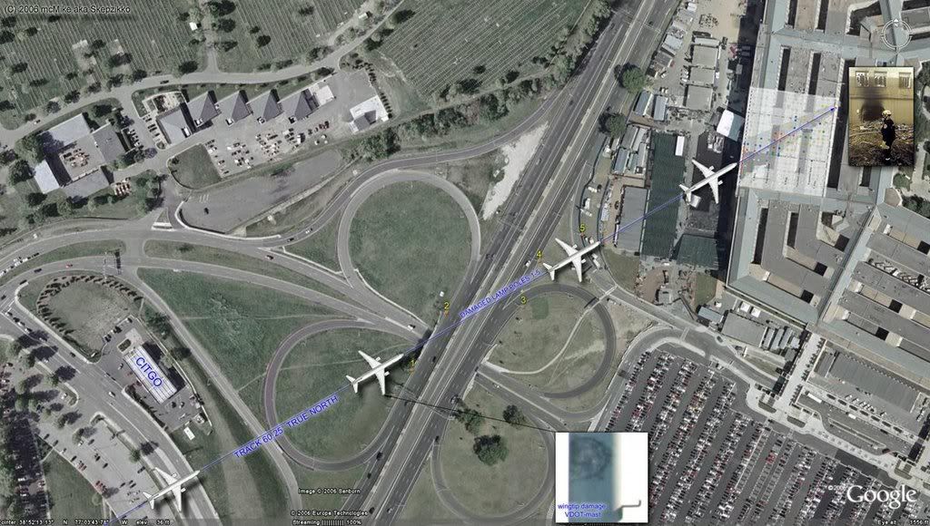
Now take note of the angle (for reference : intersects the 4 leaf clover road intersection almost dead center from the point of impact) and now go back to the wikimapia map or google earth if you wish and draw the same line this time extending outwards from the pentagon hitting all 5 poles and intersecting the 4 leaf clover junction. Also remember there is no room for error in this path as it will miss atleast one of the downed light poles and thus not remain true. The further you zoom out the wider apart the NTSB FDR path and the official trajectory drift apart. You could simply make aprint out of the map and use a simple pencil and ruler and do these aswell.
Also all this is because you don't believe in the authencity of the Flight Animation which is available from the NTSB, but still you get the same results.
Also the FAA also released an animation, exactly the same as the NTSB in its flight path
http://www.youtube.com/watch?v=dHjN4sfyqIc
Pause at around 0.27 to see the flight path drawn over a sat map, it also misses all 5 light poles and this contradicts the govt trajectory.
Also no comment on ace of the skies Hani Hanjour and his victory lap
